Sunday, November 11, 2012

Sporting Clays - Fall, 2012


The Blasting of the Clays


In October, my brother Eric and childhood friend Curt ventured to two shooting clubs, on in Illinois and one in Michigan, for a few days of sporting clay shooting.  For those who are unfamiliar with the sport of sporting clays, perhaps some background would be helpful.

Sporting clays is a form of "clay pigeon shooting" that goes back to the early 1900's in England.  A number of shooting schools used clay targets to practice for game hunts, specifically for birds.  The sport has evolved, as most sports do, to the point where many call sporting clays "golf with shotguns".

A round of sporting clays typically includes 10 to 15 stations at which skeet (small clay discs) are automatically thrown at varying distances and angles away from or crossing to the shooter.  The object is to hit as many of the disks as possible.

The Day Begins

On Sunday, Oct. 21, Curt and Eric and I traveled to the Deer Creek Sportsmans Club near Three Oaks, MI.  Arriving on a very sunny and somewhat cool day, we checked our gear and welcomed the fourth and fifth shooters of the day; Bill and his son Andrew.  We checked in at the clubhouse and headed out onto the course.  Eric, Curt and I walked the course while Bill and his son, thanks to a coupon from Groupon, "rented" a cart (think golf cart on steroids) to haul their gear.  They were nice enough to allow Eric, Curt, and I to dump some of our gear onto the cart to save us from hauling it along the course.

Safety First

As with any sport, safety is key.  All shooters are required to wear safety glasses and ear projection.  Guns remain unloaded until the designated shooter is on the stand and others are ready to observe.  Many people also wear blaze orange (a very, very good idea).  Since the day was due to warm up, layers were key.  Since we anticipated doing a lot of walking, water-proof hiking boots/shoes were also a very good idea.

Equipment

Equipment needed to participate in sporting clays includes a shotgun, safety glasses, hearing protection, ammunition, and in many cases, something to carry your gear.  The shotgun of choice is usually a 12 gauge, over-and-under (or as the British call it...an Up and Under).

I use a Browning Citori Hunter with a 28" barrel.  I have my gun set to fire the lower barrel first, followed by the upper barrel.  The ammunition used varies by personal choice; most shooters use target loads with shot size varying between 7 and 8 1/2 (the lower the number, the larger the pellets).


Report Pairs vs. True Pairs

Eric stands ready, Bill launches,
Andrew observes
Approaching the first shooting station, we prepared for and afternoon of shooting.  Once we decided who would shoot first, we noted the challenge presented by the station.  At most shooting stations, the shooters are presented with either the challenge of Report Pairs or True Pairs.  At a Report Pair station, one shooter stands ready and calls "Pull".  At "Pull" the launcher (one of the other shooters) launches the first skeet ("A").  The second the shooter pulls the trigger (thereby creating the gun "report"), the launcher sends the second ("B") skeet flying and the shooter tries to hit it.

At a True Pair station, the shooter calls "Pull" and the launcher sends both the "A" and "B" skeet flying at the same time.  The shooter then has to hit (or try to hit) both birds on before they hit the ground.

While some shooters keep score, we usually choose not to.  It's more fun (for us, anyway) that way.

Those Damn Orange Discs

A skeet launcher
The skeet are launched by electrically powered launchers that, in sporting clays, are typically hidden near the shooting station.  They are hidden in order to simulate true bird hunting and while some shooters take "free looks" (launching skeet w/out shooting to see where they fly from and to observe their trajectory) others choose to shoot as they see them.  Most skeet are about 4.25"in diameter although there are smaller ones we call "aspirin".

Sunday, September 30, 2012

Beaver Lake Basin Hike

A Hike Through Time

The Beaver Lake Basin Wilderness Area
Pictured Rocks National Lakeshore


On Saturday, September 29, 2012, my two friends (Chuck and Pish) and I hiked into the Beaver Lake Basin Wilderness Area which is part of the Pictured Rocks National Lakeshore (PRNL).  We had wanted to do this hike for some time and the day provided us with the perfect opportunity.  Cool (55 degrees), mostly clear with broken clouds, and not a bug in the air.  The three of us met at Chuck and Pish's house shortly before 9 a.m. for the hour-long ride to the trail head.

Picture Rocks - Some History

The Pictured Rocks National Lakeshore is located on the southern shore of Lake Superior in Alger County, MI.  The Lakeshore extends for approximately 42 miles along the shore and was established by the U.S. Congress in 1966 (the first officially designated National Lakeshore in the United States.  The Lakeshore is governed by the National Park Service.  It covers approximately 73,000 acres and hosts more than 470,000 visitors each year.

The Beaver Basin Wilderness Area

In 2009, President Obama signed the Public Land Management Act which, among other actions, created the Beaver Basin Wilderness (BBW) within the Pictured Rocks National Lakeshore.  Encompassing more than 11,700 acres, the BBW also includes more than 13 miles of L. Superior Shoreline, and extends some 3.5 miles from the shoreline southeast into the wilderness of Michigan's Upper Peninsula.  The BBW includes individual and small group camping along 8.4 miles of North Country Trails and 8.5 miles of connecting trails.  Hunting, fishing, day hiking, overnight backpacking, canoeing, kayaking, and snowshoeing keep visitors busy.

The two main lakes in the BBW include Beaver Lake and Little Beaver Lake.  Numerous cold water creeks feed the lakes.  Brook trout,  various  species of bass, and norther pike lurk in the depths of the two lakes.  Boating is permitted with electric motors only.

Our Hike


Chuck and Pish
Chuck  and Pish (my hiking partners) are both accomplished outdoor enthusiasts.  I've been fortunate enough to accompany them on many hikes in and around Marquette county (and elsewhere).  As noted, we drove from Marquette to the Beaver Basin Wilderness Area pretty early in the morning.  Fall hiking is always dicey in the north country because one never knows how to dress.  Layers are best.  Snacks, plenty of water, hiking staffs, and some extra layers completed the contents of our day-packs. 
After an hour and 15 minutes, we arrived at the trail head which is located off of H-58, approximately 20 miles east of the town of Munising.  The parking lot at the trail-head was full - not a good sign.  A quick check of our gear and one quick check of the posted trail maps and we headed into the woods.

Hiking through the BBW was an enchanting experience.  The trails winds through many different terrains ranging from swampy lowlands to dry upland mature beech/maple forests.  Unique rock formations could be seen at almost every turn early in the hike.  Our goal was to circumnavigate both the Little Beaver Lake and Beaver Lake itself.  We thought our hike would cover approximately 8.0 miles.  We were wrong!

After about 90 minutes, our route took us to bluffs about 30 feet above Lake Superior; the perfect place for lunch.  Spreading a tarp, we enjoyed a lunch of trail mix, water, apples, strawberries, cheese, crackers, spinach dip, humus and crusty bread.  One must remember that nutrition on the trail is important.

After lunch, we hoisted our packs once again and continued along the Lake Superior bluff for a few miles, then headed southeast back into the woods.  Our route took us along the northwest shore of Beaver Lake, until we curved to the right, heading more  southwest along the south shore of Beaver Lake.  Watching our GPSs and the maps we carried, we soon realized that our distance estimate was off and our total hike would most likely be 12+ miles.  Our legs ached at the thought,but we pressed on through a mix of mature coniferous forest.  When the trail would dip into lowlands, cute bridges would help us over the streams.

Towards the end of our hike (will this trail ever end?), we came across some of the group campsites near the southern most tip of Beaver Lake.  Very nice spots directly adjacent to of of many small bogs we came across.

Arriving back at the parking lot, we unloaded our gear, stretched, loaded the car and headed back to Munising for bottled water for the trip home.  As it turns out, we didn't need to worry about the full parking lot we noticed when we arrived.  We saw about eight people on the trail the entire day.

Arriving back in Marquette, Chuck, Pish, and I enjoyed dinner with two other friends who couldn't hike with us.  The grilled wild-caught salmon in a jerk marinade, steamed broccoli, scalloped potatoes, and more than our fair share of Pinot Noir set the stage for a wonderful homemade apple/pear crumble and vanilla ice cream for dessert. 

Hey, we earned it!
_____

More pictures:

 
A cave underneath one of the rock cliffs.


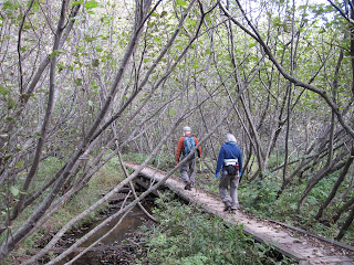
Chuck and Pish head down the trail.

Bog


Trail through pines.


Friday, July 6, 2012

Cayman Brac - Diving in Paradise


Introduction

In June of 2012, Eric and Rob (my two brothers) and I joined a group from DJ's Scuba Locker (dive shop in Lyons, IL) on a six day, seven night dive trip to the Cayman Islands.  More than 20 of us spent a week exploring the reefs (and one wreck) surrounding Cayman Brac, the middle sized Sister Island.  A great time was had by all.  Here are some of the details

A Little History

The first logged sighting of the Cayman Islands took place on May 10, 1503 by Christopher Columbus during his fourth and final voyage to the New World.  The first recorded English visitor to the islands was Sir  Francis Drake in 1586.  He is credited with naming the Islands "Cayman" after caiman, a Neo-Taino word for "alligator".  During its history, the islands played host to a variety of settlers including pirates,  refugees from the Spanish Inquisition, shipwrecked sailors, and deserters from Oliver Cromwell's army in Jamaica.

The English first took control of the Cayman Islands, along with Jamaica, under the Treaty of Madrid in 1670.  Many of today's island inhabitants are of African and English descent.  In Islands continued to be governed as a part of the Colony of Jamaica until 1962 when the Islands became a separate Crown colony.

In September of 2004, the Cayman Islands, which lie pretty much at sea level, were hit by Hurricane Ivan.  The storm surge flooded many areas of Grand Cayman and it is estimated that 95% of the buildings on the island were damaged or destroyed.  In two years however, the majority of the island's infrastructure was returned to normal.   Because of its tropical location, it  is estimated that the Caymans Islands are hit or brushed by a hurricane every 2.23 years.

Geography

The Cayman Islands are located in the western Caribbean Sea and are, in reality,the peaks of a massive underwater ridge known as the Cayman Ridge (or the Cayman Rise).  The Ridge flanks the Cayman Trough which drops to an ear popping 20,000+ feet into the "Deep Blue" as the natives call the deep ocean.  The Cayman Islands are made up of three separate islands; Grand Cayman (76 sq.mi.) and the two Sister Islands; Cayman Brac (38 sq. mi) and Little Cayman (28.5 sq mi).  We stayed on Cayman Brac.

Most of the three islands are flat with the exception of the eastern part of Cayman Brac which host "The Bluffs" which gradually rise to more than 140 ft. above sea level.  Roughly translated, "Brac" is a Gaelic word meaning "bluff".

Diving

In 1957, dive operator Bob Soto began the islands' first recreational diving business and introduced the world to the pristine waters off of Grand Cayman and the Sister Islands.  In June, 2012, I was fortunate to experience first-hand the wonders of the underwater world of the Cayman Islands.

Our Trip


My Dive Log

All divers should keep a log of their dives.  Here is a quick summary of the dives I did on Cayman Brac:

June 10th

Dive #1 - East Chute
76' for 36 minutes

Dive #2 - Charlie's Reef
57' for 1 hour, 2 minutes

Dive #3 - Preacher's Barge
43' for 1 hour, 2 minutes

June 11

Dive #1 - Knuckle's Reef/Wall
84' for 47 minutes

Dive #2 - Radar Reef
54' for 1 hour, 4 minutes

Diver #3- Angelfish Reef
61' for 56 minutes

June 12

Dive #1 - Eden Wall
89' for 47 minutes

Dive #2 - Butterfly Reef
59' for 57 minutes

June 13 (Dives #1 and #2 on Little Cayman.  Dive #3 on Cayman Brac)

Dive #1 - Dot's Hot Spot
90' for 51 minutes

Dive #2 - Cumbers Cave
50' for 59 minutes

Dive #3 - End of Island
59' for 59 minutes

June 14

Dive #1 - Ken's Mount
90' for 45 minutes

Dive #2 - Kinder's Kingdom
72' for 53 minutes

Dive #3 - Snapper Point
67' for 49 minutes

June 15

Dive #1 - Wreck of No. 356
81' for 52 minutes

Dive #2 - Snapper Road
43' for 1 hour, 4 minutes.


Friday, May 25, 2012

Top of the World Fire - Middle Island Point
May 24-25, 2012

On Friday,  May 25, 2012, a fire was detected at what's typically called Top of the World by many Association members.  Several members of the Association responded with shovels, etc. while the Marquette Township Volunteer Fire Dept. was called.  Two trucks responded; the smaller truck on the upper parking lot and the larger truck in the main, lower parking lot.  The large truck  pumped fire-fighting foam to the smaller truck which sprayed the foam that smothered the fire.  No one was injured and no structure was damaged.  The fire scorched approximately 1/2 to 3/4 of an acre of tinder dry forest.  No trees were lost and the fire was confined to the forest floor.

If it were not for the quick action of the fire department and members of the Association, this could have been much, much worse.

Here are some pictures from the fire site.: